Why Hike the GR20 Trail & What Makes It Special
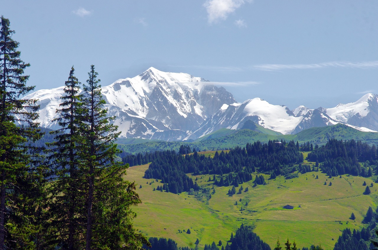
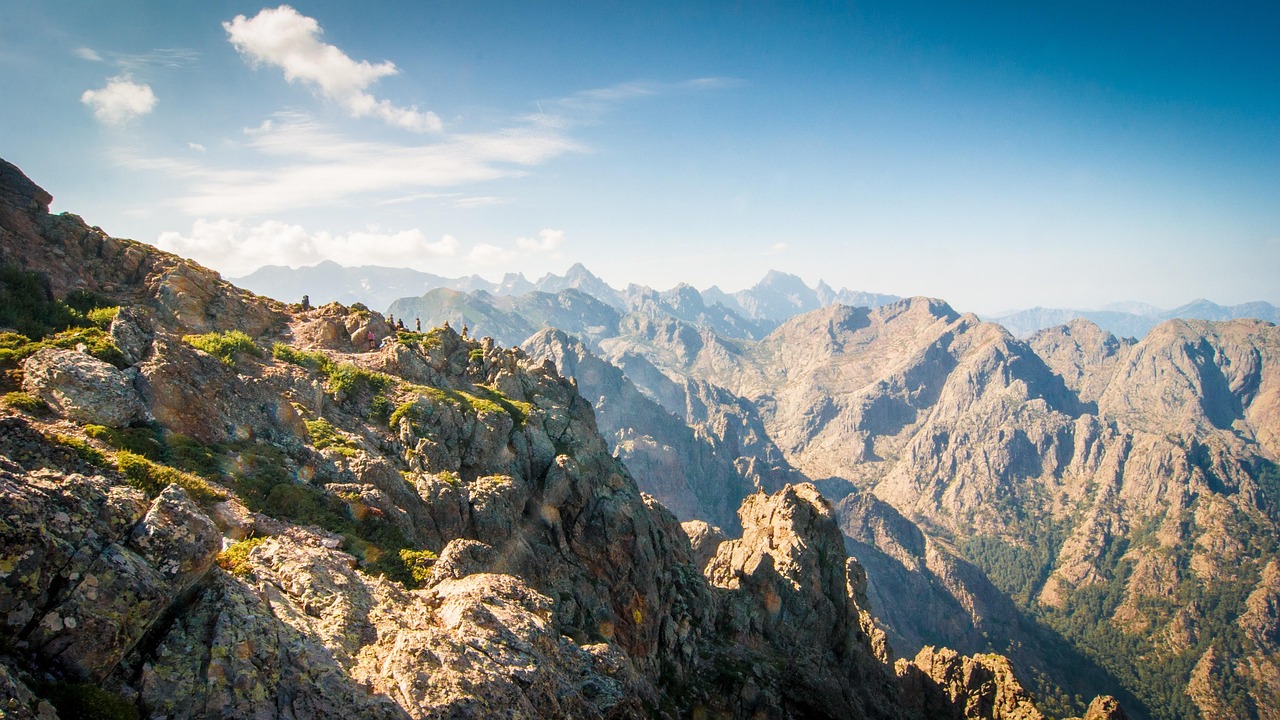
The GR20 is not just a hiking trail; it’s Corsica’s backbone, a rocky spine that crosses the island diagonally from Calenzana in the north to Conca in the south. Over roughly 180 km of high-level terrain, it stitches together jagged ridges, lonely shepherd huts, hanging valleys, and forested descents into what many consider Europe’s toughest — and most rewarding — waymarked trek.
I’ve been guiding and walking the GR20 since my early twenties. I’ve seen it in an angry June snowstorm, in the dusty gold of late September, and in the soft pink dawns of mid-July when the granite glows and the only sound is the bells on semi-wild pigs far below. Every time, I forget the blisters and remember the moments: swimming in an icy tarn above Refuge de Carrozzu after a brutal climb, watching a thunderstorm roll in over the Cirque de la Solitude back when it was still open, sharing chestnut beer with shepherds near Asinau, or guiding a nervous family with teens up the Spasimata slabs and seeing their confidence grow with every step.
What makes the GR20 special is not just the difficulty, but its variety. One day you’re edging along chains and scrambling over boulders; the next you’re wandering through pine forest with the smell of wild immortelle in the air. Along the way you stay in simple mountain refuges, private bergerie guesthouses, or under the stars in your tent. You eat brocciu cheese, fig jam, lonzu, coppa, civet de sanglier, and rough country bread. You wash in rivers, you talk to strangers, and you forget your phone exists except to check the weather and the map.
In this 2026 travel guide for GR20 Trail, I’ll treat the route like a long-distance “road” through the mountains, split into a flexible 7–14 leg itinerary for GR20 Trail. I’ll walk you through the best places to visit on GR20 (refuges, summits, lakes), things to do on GR20 off the main track, where to eat and sleep, and how to plan your logistics whether you take the 7 legs of GR20 Trail, 8 legs, 9 legs, 10 legs, 11 legs, 12 legs, 13 legs, or 14 legs itinerary. I’ll also share the hidden gems in GR20 Trail, like a family-run bergerie that grills lamb over open fire, and a side-path to a waterfall where I often take my groups for a secret swim.
Table of Contents
- Why Hike the GR20 & What Makes It Special
- Overview: The GR20 Route & How Many Legs to Walk
- Suggested 10-Leg Itinerary (Adaptable to 7–14 Legs)
- Leg 1 – Calenzana to Ortu di u Piobbu
- Leg 2 – Ortu di u Piobbu to Carrozzu
- Leg 3 – Carrozzu to Ascu-Stagnu
- Leg 4 – Ascu-Stagnu to Tighjettu & Ciottulu di i Mori
- Leg 5 – Ciottulu di i Mori to Castel di Vergio & Manganu
- Leg 6 – Manganu to Pietra Piana & Onda
- Leg 7 – Onda to Vizzavona (Midpoint & Family-Friendly Pause)
- Leg 8 – Vizzavona to Capannelle & Prati
- Leg 9 – Prati to Usciolu & Asinau
- Leg 10 – Asinau to Bavella & Conca (Southern Finale)
- 18 Key Route Stops & Viewpoints in Detail
- Eating & Sleeping on the GR20
- Evenings on the GR20: Refuges, Stars & Small Villages
- Day Trips & Nearby Attractions off the GR20
- Culture, Etiquette & Local Customs
- Practical Logistics & Travel Advice for GR20
- Events & What’s New in 2026–2027
- Summary & Best Seasons to Hike the GR20
Overview: The GR20 Route, Direction & How Many Legs
The classic GR20 runs from Calenzana in the Balagne region (near Calvi) to Conca in the south (near Porto-Vecchio). Traditionally it is split into two parts:
- GR20 Nord: Calenzana to Vizzavona — steeper, more technical, more rugged.
- GR20 Sud: Vizzavona to Conca — still demanding but generally less technical, with more rolling ridgelines and big skies.
Most hikers take 12–16 days. For this GR20 Trail road trip itinerary on foot, I’m going to frame it as a 10-leg itinerary, each leg being roughly 1–2 days of walking. That lets us talk meaningfully about the 7 legs of GR20 Trail (for strong hikers who double up stages), and the 14 legs of GR20 Trail (for those who prefer shorter days), because they are all variations on the same backbone.
Direction: I always recommend hiking north to south (Calenzana → Conca). You tackle the hardest technical sections first while your legs are fresh. Psychologically, the GR20 Sud feels like a long victory lap — you’re fitter, more mountain-savvy, and the views open out towards Sardinia and the sea. South-to-north is possible (and some purists love “saving the hardest for last”), but most of my clients who tried that once don’t repeat it.
Vehicle suitability? This is a footpath, not a driving route, but the logistics feel very similar to a road trip: staging villages, resupply points, transport in and out, and a chain of overnight stops. You’ll still think in terms of “legs”, “fuel” (food & water), “road conditions” (snow, heat, thunderstorms), and “breakdown options” (bail-out trails to roads and villages).
Suggested 10-Leg Itinerary for the GR20 (Adaptable to 7–14 Legs)
Below is my personal favorite 10 leg itinerary for GR20 Trail, which divides the route into natural segments around major refuges, passes, and villages. Strong parties often compress this into a 7 leg itinerary by linking some of these legs together; those who prefer an easier pace stretch it to an 11 leg itinerary, 12 legs, 13 legs, or 14 legs of GR20 Trail by splitting the longer crossings and adding rest days in Vizzavona and Bavella.
- Leg 1: Calenzana → Ortu di u Piobbu
- Leg 2: Ortu di u Piobbu → Carrozzu
- Leg 3: Carrozzu → Ascu-Stagnu
- Leg 4: Ascu-Stagnu → Tighjettu → Ciottulu di i Mori
- Leg 5: Ciottulu di i Mori → Castel di Vergio → Manganu
- Leg 6: Manganu → Pietra Piana → Onda
- Leg 7: Onda → Vizzavona (Midpoint)
- Leg 8: Vizzavona → Capannelle → Prati
- Leg 9: Prati → Usciolu → Asinau
- Leg 10: Asinau → Bavella → Conca
Each leg in this travel guide is written like a mini road-story: where I stayed, what I ate, the best things to do in GR20 Trail around that segment, plus must-see attractions, local food in GR20 Trail refuges and bergeries, and travel tips for GR20.
Leg 1 – Calenzana to Ortu di u Piobbu: Into the Spine of Corsica
Every GR20 season for me begins in Calenzana, usually with a coffee at the terrace of a small bar on the main square, watching hikers nervously adjust their pack straps. The village, at just 275 m above sea level, feels almost Mediterranean: olive trees, terracotta roofs, the call of doves. It’s a far cry from the granite world you’ll enter by the end of the day.
The trail climbs quickly through maquis — fragrant scrub of cistus, myrtle, and rockrose. In June 2025, I guided a couple from Canada here on their first European trek. The husband kept stopping to sniff the air and say, “It smells like someone spilled a perfume bottle.” By mid-morning, your shirt will be damp and Calvi’s gulf will shine behind you like a promise.
Ortu di u Piobbu Refuge: First Night in the High Country
The last stretch to Refuge Ortu di u Piobbu is where the GR20’s reputation begins to show. The path steepens and scrambles across rocky steps. On my 2023 solo traverse, I arrived late afternoon in a haze of heat and dust to find the refuge bathed in golden light, the ridge line above it etched against a cobalt sky.
Ortu di u Piobbu sits around 1,570 m, perched on a natural balcony. The original refuge burned down several years ago; the new structure is more fire-resistant, practical rather than romantic, but the surroundings still feel wild. It’s usually your first taste of GR20 refuge life: queue for water, find your tent pitch, stake it fast because mountain winds can get playful, then join the dinner line.
Food & Practical Tips for Leg 1
- Where to sleep:
- In Calenzana: family-run B&Bs like simple stone houses converted into guest rooms. I often stay with a local family who serve homemade fig jam and strong coffee.
- At Ortu di u Piobbu: dormitory bunks (book early for July–August 2026), tent rental, or your own tent in the designated camping area.
- What to eat: Calenzana bakeries are your last “civilized” bread for a while. Stock up on ficatellu sausage, cheese, and fruit. At the refuge, typical meals include pasta with tomato sauce and local cheese, or lentil stew with bread. In 2025 they were also offering a simple omelette with herbs for vegetarians.
- Water: Start Leg 1 with at least 2 L of water per person; the climb can be hot even in June. There is a water point about halfway up, but it’s seasonal and I never rely on it completely.
- Difficulty: Around 6–7 hours of ascent with a heavy pack. For families with teens who are new to multi-day trekking, I sometimes break this into a shorter first half day, staying in Calenzana and starting early next morning to avoid heat.
This first leg is where you test your pacing. On my first GR20 in my twenties, I charged up from Calenzana and arrived at Ortu completely wrecked, blisters already forming. These days, I take deliberate, small steps; the GR20 rewards patience far more than speed.
Leg 2 – Ortu di u Piobbu to Carrozzu: Slabs, Ridges & the Spasimata Bridge
Leaving Ortu di u Piobbu at dawn is one of my favorite moments on the northern GR20. The air is cold enough that you can see your breath, and the first light catches the ridges in pink. This stage is where you begin to understand why the GR20 is described as a high-level route: you’re often traversing above treeline, moving from col to col across broken, sometimes exposed terrain.
The route from Ortu di u Piobbu to Refuge de Carrozzu involves a climb to a high pass, a descent into rocky bowls, and then the famous Spasimata slabs, polished rock ramps that can be slippery when wet. On my 2024 trip, a short rain shower turned these into a slow, careful dance; we moved like a cautious caravan, packs pressed into the rock, using the cables as needed.
The Spasimata Footbridge
Near the end of the stage, just when you’re starting to wonder how far it can be, you reach the Spasimata stream and its iconic steel suspension bridge. For years, this narrow, slightly bouncy bridge — spanning a deep, clear pool — has been one of the must-see attractions in GR20 Trail photo albums. In 2025, I watched a family with two kids cross it, the youngest clinging to the side cables, then whooping in triumph on the other side.
Below the bridge are perfect rock slabs for lazing and pools for brave swimmers. The water is glacial, but on a hot July afternoon I often bring my groups here for 20–30 minutes of icy immersion therapy. It’s one of the best family friendly moments on the northern half — as long as you watch the kids carefully and keep them away from wet, slippery edges.
Refuge de Carrozzu: In the Pines
Carrozzu (around 1,275 m) is tucked into a forested valley. Compared to Ortu, it feels more sheltered, with tall pines and stones warmed by the afternoon sun. The terrace, simple as it is, has one of my favorite “end-of-day” vibes: boots off, socks steaming, people trading stories.
Food, Hidden Gem & Tips for Leg 2
- Hidden gem: About 10 minutes downstream from the Spasimata bridge (on faint paths used by shepherds and swimmers) is a slightly deeper, less crowded pool. I stumbled upon it in 2019 when we were looking for a quiet lunch spot. If you go, tread softly, leave no trash, and don’t build cairns.
- What to eat: Carrozzu usually serves a hearty, basic dinner — often soup, pasta, and a piece of fiadone (Corsican cheesecake) or fruit for dessert. Portions can feel small if you’ve had a big day; I always carry an emergency stash of nuts and dried figs.
- Leg variants: Strong parties sometimes merge Leg 1 and Leg 2 into a single huge day Calenzana → Carrozzu. Personally, I advise against it for most — unless you’re specifically chasing a 7 legs of GR20 Trail fast itinerary and you’ve trained for it.
- Weather warning: The slabs near Spasimata become hazardous in thunderstorms. If dark clouds are building and thunder is rumbling, do not push on just to “keep the schedule”; I’ve twice turned clients back and waited a few hours rather than risk it.
Leg 3 – Carrozzu to Ascu-Stagnu: High Passes & a Ski Station in Summer
From Carrozzu, the GR20 climbs again, crossing a dramatic suspension of the northern range to reach the former ski station of Haut Asco (Ascu-Stagnu). This leg is a bridge between the lonelier granite world and a more accessible mountain hub, where hot showers and proper mattresses suddenly reappear.
Traditionally, this section funneled hikers towards the notorious Cirque de la Solitude, a steep and dangerous gully that claimed several lives. Since 2015, that variant has been closed, and the main GR20 now uses a higher alternative route. It’s still alpine and exposed, but in good conditions it’s straightforward for careful, sure-footed trekkers.
Arrival at Ascu-Stagnu
Ascu-Stagnu is a strange, almost surreal place to reach on foot. In winter, it’s a tiny ski area; in summer 2026 it will once again be buzzing with GR20 hikers, day-trippers, and families exploring the surrounding trails. A paved road reaches here, so you suddenly see cars, motorbikes, even the occasional tour bus — a shock after two days of purely foot-borne travel.
On my last crossing, I arrived with a client nursing a sore knee. We checked into a room at the gîte, and the sheer luxury of a real bed and thick mattress almost made us weep. That evening we had civet de sanglier (wild boar stew) with creamy polenta and a carafe of local red wine at the station restaurant, sharing a table with two trail runners attempting the full GR20 in under six days. It’s that mix of cultures that defines Ascu: hardened fastpackers, slower hikers, and holidaymakers all rubbing shoulders.
Family-Friendly Options from Ascu
For families or couples not up for the entire GR20, basing in Ascu-Stagnu for a couple of nights offers a taste of the trail without committing to the whole thing. Short walks to nearby viewpoints, river swims in the Asco valley, and chairlift-assisted outings (when running) make it one of the more accessible things to do on GR20 Trail for visitors arriving by car from the coast.
Tips for Leg 3
- Where to sleep: Refuge-like gîte at Ascu, or small hotel-style rooms. Book ahead in 2026; weekends can be busy with local Corsican families.
- Resupply: There is usually a small shop at Ascu-Stagnu with basics (pasta, biscuits, chocolate, gas canisters). Prices are higher than in the valley, so don’t rely on doing a full shop here if you’re on a tight budget.
- Weather & safety: This section can still hold snow early in the season (late May–mid June). In 2022 we needed microspikes above 2,000 m in early June; by late June 2025 it was snow-free but still had some wet, loose scree. Check with the PNRC (Parc Naturel Régional de Corse) or refuge wardens for up-to-date conditions.
Leg 4 – Ascu-Stagnu to Tighjettu & Ciottulu di i Mori: Among the High Peaks
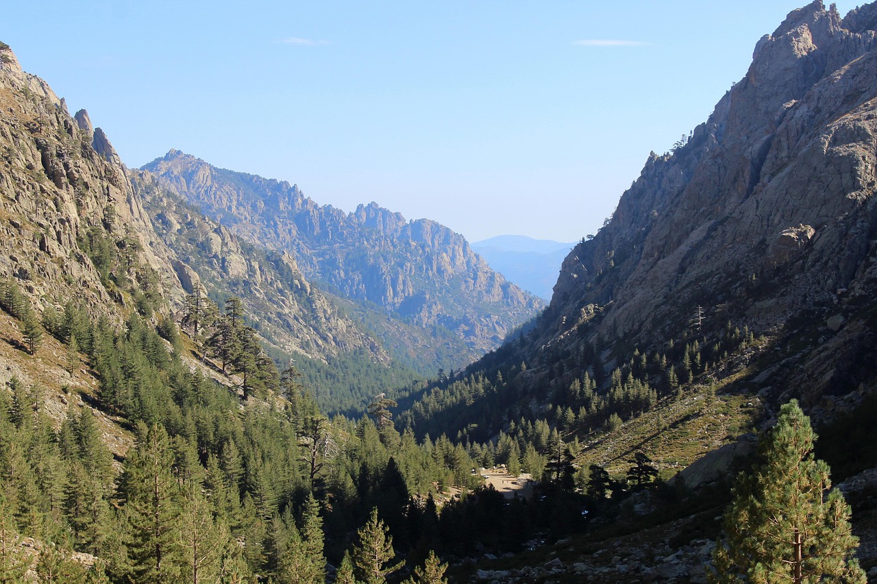
For many, this is the heart of the northern GR20: high, rocky, and gloriously remote. Leaving Ascu-Stagnu, you climb steeply towards some of Corsica’s highest peaks. On a clear day, the granite walls around you look almost Alpine; on a misty day, they loom like something from a legend.
The route passes near the hulking massif of Monte Cinto (2,706 m), Corsica’s highest mountain. Ambitious, experienced scramblers sometimes add a side trip to its summit (not for beginners or in poor weather). I’ve done it twice; both times I was rewarded with views that stretched from the sea to snow patches, but I only ever guide it with very fit, capable parties and a conservative weather window.
Refuge de Tighjettu
Tighjettu is one of the more “classic” feeling refuges: stone walls, a rugged setting, and a strong sense of being perched on the edge of the high mountains. I arrived here once in a cold September drizzle, and the guardian had a pot of thick vegetable soup going. We crammed into the shelter, boots steaming, to eat, talk, and share the last of someone’s bottle of muscat du Cap Corse.
Ciottulu di i Mori: Balcony Above the Golo
Some hikers stop the day at Tighjettu; others continue to Refuge de Ciottulu di i Mori, at about 1,990 m, one of the highest refuges on the trail. It sits above the young Golo river, which you’ll later cross as a clear, tumbling stream but which eventually becomes one of Corsica’s major rivers.
On my 2020 traverse, we pushed on to Ciottulu in a long, tiring day. We arrived just as the sun was dropping, turning the whole valley into a wash of orange and purple. That night, the sky was so clear that you could see the Milky Way as a bright river; I lay outside my tent, wrapped in my sleeping bag, until the chill finally forced me in.
Tips & Hidden Detours for Leg 4
- Double or single stage?
- For a 10 legs of GR20 Trail itinerary, I often do Ascu-Stagnu → Ciottulu in one long day with strong, acclimatized groups.
- For a 12 leg itinerary or slower party, break it: Ascu-Stagnu → Tighjettu, then Tighjettu → Ciottulu next day.
- Water & heat: In late summer, some high streams can run low. At both Tighjettu and Ciottulu, check water availability reports in advance (2026 is forecast to be another relatively dry summer).
- Side trip: If conditions are perfect and you’re experienced, consider a non-technical but demanding out-and-back towards Monte Cinto from the vicinity of Tighjettu or Ciottulu. Only do this if you have extra time and energy; it is not essential to the GR20 and should never be attempted in storms.
Leg 5 – Ciottulu di i Mori to Castel di Vergio & Manganu: From High Granite to Pastoral Valleys
Leg 5 is where the character of the GR20 begins to shift. From Ciottulu di i Mori, you descend gradually into the upper Golo valley, following the newborn river as it gathers strength among granite slabs. It’s one of the gentlest mornings on the northern half, and I often see shoulders relax, steps lengthen, and conversations start to flow.
Castel di Vergio: A Roadside Oasis
Eventually, you reach Castel di Vergio, a small road pass with a hotel, gîte, and camping. After several days of pure foot travel, seeing parked cars and motorbikes again can be strangely jarring. It’s also an excellent “fuel stop” point in the metaphorical GR20 road trip: you can buy a few supplies, enjoy a proper espresso, and — if you’re anything like me — demolish a plate of fries and grilled meat with a side of green salad.
For those building a 7 leg itinerary for GR20 Trail, Castel di Vergio often serves as an anchor. You might combine Ciottulu → Vergio → Manganu into a single big day; for gentler itineraries (12–14 legs), some hikers overnight here for a taste of sheets and hot showers before returning to tent life.
Lac de Nino & Manganu Refuge
Beyond Castel di Vergio, the trail climbs gently through forest and open pasture to one of the most beloved spots on the GR20: Lac de Nino. This shallow, grassy-edged lake sits in a high plateau ringed by gentle hills. Semi-wild horses graze here, and their reflections often shimmer in the water on still days.
On my 2025 crossing, we reached Lac de Nino just as a bank of mist rolled in, softening all edges and making the place feel otherworldly. We ate lunch sitting on the grass, sharing cheese and dried figs while horses nosed closer, hoping for a bite. It’s a romantic spot if you catch it in the evening light, and one of the few places along the GR20 where couples sometimes linger, just silently watching the scene.
From the lake, a relatively easy traverse leads to Refuge de Manganu, set on a high plateau with broad views. Manganu’s camping area sprawls across a gentle slope, which can get windy, but on a clear night the stargazing is exceptional.
Food, Atmosphere & Tips for Leg 5
- Local dishes at Vergio: Grilled pork or lamb with pommes frites, hearty mountain soups, and local cheese plates. If their fiadone is on offer in 2026, don’t skip it.
- At Manganu: Meals are more basic but filling — think risotto-like rice dishes, bean stews, and generous bread. In 2024, the guardian experimented with a vegetarian lentil curry that was surprisingly good.
- Family-friendly factor: The trail between Castel di Vergio and Lac de Nino is one of my top recommendations for families looking for a day hike that touches the GR20 without committing to its hardest sections. Start early, bring a picnic, and let the kids run on the plateau (within reason).
Leg 6 – Manganu to Pietra Piana & Onda: Ridges, Lakes & Weather Games
This is one of the most beautiful — and weather-sensitive — legs of the GR20. From Manganu, the trail climbs to a high plateau dotted with tarns and boulder fields, then to the Breche de Capitellu, a high notch overlooking the deep blue waters of Lac de Capitellu and Lac de Melo far below. The scale is impressive: sheer cliffs, shining lakes, and often a chilly wind.
On my 2021 crossing, we arrived at the breche under a perfect blue sky and spent 30 minutes just sitting above the lakes, tracing out the path we’d taken the year before from the Restonica valley below. In 2018, by contrast, we had to move quickly under building thunderheads, watching lightning strike distant ridges. It’s a place that teaches respect for mountain weather.
Refuge de Pietra Piana: A Windy Balcony
Pietra Piana occupies a spectacular, exposed site on a shoulder overlooking deep valleys. The refuge itself is fairly simple, but the setting is wild — clouds can roar up from below and swallow everything in minutes. I remember one July evening when we watched a sea of white pour in, leaving only the highest peaks as “islands” in an ocean of cloud.
From Pietra Piana, many hikers continue the same day to Refuge de l’Onda, descending into forest and then climbing again to this more sheltered spot. Others split the day in two, particularly if storms are building or knees are tired. Onda has a lovely, more intimate feel, with grassy camping terraces and a good sense of community on summer evenings.
Tips for Leg 6
- Weather windows: If storms are forecast, I often start very early from Manganu to be past the Breche de Capitellu before midday. These high ridges are not where you want to be in lightning.
- Leg planning:
- For a 9 leg itinerary for GR20 Trail, many combine Manganu → Pietra Piana → Onda into one long day.
- For a 12–14 legs of GR20 Trail plan, treat Manganu → Pietra Piana and Pietra Piana → Onda as two distinct, shorter stages.
- Food: Both refuges usually offer standard GR20 fare, plus snacks and chocolate. In 2023, Pietra Piana occasionally had a surprisingly good local red wine by the glass — an unexpected treat at over 1,800 m.
Leg 7 – Onda to Vizzavona: Forest Descent & Mid-Route Reset
From Onda, you have two main route options to reach Vizzavona, the GR20’s traditional midpoint:
- A higher, more scenic route over ridges (better in stable weather).
- A lower, forested route following the Manganello river with beautiful pools (excellent in hot weather and for families).
I’ve walked both many times, and my choice always depends on the group and the sky. In August 2025, with a heatwave pressing down, I led my clients down to the river route. We spent a blissful hour at a large, emerald pool, swimming and eating lunch while dragonflies skimmed the surface. For me, this stretch is one of the hidden gems in GR20 Trail — not in the sense of being undiscovered (locals know it well), but in how unexpectedly idyllic it feels after the harsh granite of the north.
Vizzavona: A Natural Pause
Vizzavona is a mountain pass with a handful of hotels, gîtes, a campsite, and a train station that links Ajaccio and Bastia. It’s the perfect reset point: clean clothes, a real bed, time to re-evaluate your schedule. Many hikers end a shorter GR20 Nord itinerary here; others join here to walk only the GR20 Sud.
On my most recent traverse, I always schedule at least one rest day in Vizzavona. In 2025, we spent it wandering through the beech and pine forest, visiting the Cascade des Anglais (a series of waterfalls and pools a short walk from the station), and lingering over long lunches on the terrace of the Hôtel I Laricci. It’s one of the best places to properly shower, do laundry, and reset your pack.
Family & Romantic Angle
Vizzavona is also one of the best family friendly and romantic mini-destinations along the GR20. Couples who don’t want to tackle the whole trail sometimes base here for 3–4 days, doing day hikes (to the waterfall, nearby viewpoints), taking the little mountain train, and enjoying quiet forest evenings with a bottle of Corsican wine.
Tips for Leg 7
- Accommodation: Several options from simple gîte dorms to small hotels with private rooms. Book early for July–August 2026, especially if you want an en-suite room.
- Resupply: Small shops and hotel kiosks sell basics, but don’t expect full supermarket choice. If you need specialized food (gluten-free, vegan), plan to bring most of it onto the island.
- Itinerary pivot: This is the easiest point to change your plans. If injuries or fatigue are building, you can exit the GR20 here by train and still feel you’ve experienced the essence of the northern half.
Leg 8 – Vizzavona to Capannelle & Prati: Into the Softer South
Leaving Vizzavona, the GR20 shifts mood. The southern half still has long days and stiff climbs, but the terrain generally becomes less technical. The trail winds through forest, then climbs to open ridges with big horizons. The sense of remoteness increases again, but the jagged, intimidating walls of the north give way to softer, rolling mountains.
Capannelle: Ski Station Turned Summer Base
Capannelle is another small ski station that comes alive in summer as a GR20 hub. I have a soft spot for its gîte, where in 2022 we arrived soaked from a surprise afternoon storm and were fed endless bowls of hot soup and generous plates of charcuterie until our spirits matched our refilling stomachs.
From Capannelle, the path continues over gentle crests and through grassy bowls towards Refuge de Prati, which occupies one of the best view sites in the south. On a clear day, you can see the sea from its terrace, and if the air is especially clear in autumn, you may glimpse the hazy outline of the Tuscan archipelago.
Tips for Leg 8
- Leg combinations:
- Ambitious hikers on a 7 or 8 legs of GR20 Trail plan sometimes push from Vizzavona directly to Prati in one massive day. I rarely recommend it for enjoyment, but it’s possible.
- Most 10–12 leg itineraries treat Vizzavona → Capannelle and Capannelle → Prati as separate days.
- Family & novice options: Vizzavona → Capannelle is among the more approachable segments for hikers new to multi-day trekking. It’s still a full day, but with fewer technical sections than the northern legs.
- Food: Capannelle’s gîte cooks hearty, home-style meals; in 2024 they were particularly proud of their lasagnes au brocciu. At Prati, expect simpler refuge fare, but the view more than compensates.
Leg 9 – Prati to Usciolu & Asinau: Windy Ridges & Old Transhumance Paths
This leg is all about ridges and wind. From Prati, the trail follows high crests where the wind can be fierce enough to knock you sideways. The path is often just a faint line between rocks and clumps of grass, worn by centuries of shepherds moving flocks between summer and winter pastures.
Refuge d’Usciolu: The Wind Refuge
Usciolu is one of the most atmospheric refuges on the GR20. Perched along a long, undulating ridge, it often feels like a ship at sea in a storm of air. On my 2019 traverse, we arrived just as a band of high clouds turned deep orange at sunset, the wind whipping our jackets and everyone huddled behind low stone walls to cook.
From Usciolu, the path continues along the so-called “arête a Monda” — a sinuous ridge that forces you up and down over countless rock lumps. It’s not technically hard but can be tiring on ankles and knees. Eventually, you descend towards Refuge d’Asinau, recently rebuilt after a fire, nestled beneath the dramatic spires of the Bavella massif.
Shepherd Huts & Local Food
Between Prati and Asinau, a number of small bergeries (shepherd huts) offer simple meals and sometimes basic lodging. One of my favorites is a tiny stone hut where, in 2023, an elderly shepherd grilled lamb chops over an open fire and served them with nothing but salt, lemon, bread, and a rough red wine in plastic cups. It remains one of the best meals I’ve had on the GR20.
These bergeries are where you get some of the most authentic local food in GR20 Trail country: fresh brocciu cheese, chestnut-based cakes, figatellu, and sometimes home-made liqueurs. Carry cash — they usually don’t accept cards.
Tips for Leg 9
- Wind & exposure: Bring a proper windproof layer. Even in August, these ridges can be surprisingly cold when the wind funnels along them.
- Leg planning:
- For a 9 legs of GR20 Trail plan, some combine Prati → Usciolu → Asinau into one big push, but that’s a major day.
- Most hikers sensibly divide it into Prati → Usciolu and Usciolu → Asinau.
- Water: Sources can be scarce on windy ridges. Always top up fully at refuges and bergeries.
Leg 10 – Asinau to Bavella & Conca: The Final Descent to the Sea
The final leg of the GR20 is also one of the most scenic, threading through the spectacular Aiguilles de Bavella — jagged granite spires that are a symbol of Corsica. From Asinau, you climb steadily to a high pass with wide views, then follow rocky paths under the towers of Bavella. There are route options here: the official GR20 line and more “alpine” variants that add scrambling. With guided groups, I generally stick to the standard route unless everyone is experienced and conditions perfect.
Bavella Col: Road, Chapel & Little Bars
The Col de Bavella is another strange collision of wilderness and accessibility. A road crosses the pass, bringing tourists, trail runners, and rock climbers. There’s a small chapel, souvenir stalls, and a clutch of bars and restaurants where hikers descending from the high trail can collapse into chairs, order cold beer or lemonade, and gape at the spires they’ve just walked beneath.
On my 2017 traverse, my group arrived at Bavella around noon, and I watched their faces as they realized: This is it. The toughest parts are behind us; the rest is a long, triumphant descent. We toasted with Pietra beers (Corsican chestnut beer) and shared plates of charcuterie and fromage corse.
Descent to Conca: The Long Goodbye
From Bavella, the GR20 continues on a mix of paths and forest tracks, gradually losing altitude until you reach the village of Conca. The landscape becomes increasingly Mediterranean again: cork oaks, maquis, the smell of hot resin, and eventually glimpses of the sea.
Arriving in Conca is always emotional, no matter how many times I’ve done it. There’s a small bar where you can officially “sign off” and often meet other hikers you’ve leapfrogged with along the route. The feeling of taking off your pack and knowing you don’t have to put it back on tomorrow is indescribable.
Tips for the Final Leg
- Celebration: Many hikers plan a night in Conca or, more commonly, transfer down to the coast near Porto-Vecchio for a night or two of beach recovery. Book coastal accommodation in advance for July–August 2026.
- Transport: Shuttle services run between Conca and Porto-Vecchio in season; some continue to Bastia or Ajaccio. In the shoulder seasons, you may need to pre-arrange a taxi.
- Family & romantic options: The Bavella area, with its short walks and rock-climbing routes, is a wonderful base for adventurous couples and families who like via ferrata, canyoning, or scenic drives combined with short hikes.
18 Key Route Stops & Viewpoints on the GR20 (With Anecdotes & Tips)
Beyond the legs, here are 18 of the most must-see attractions in GR20 Trail land — refuges, passes, lakes, and viewpoints that anchor the experience. Some we’ve already visited in the itinerary above; here I’ll add a bit more context, history, or personal color.
1. Calenzana: Gateway to the GR20
Why it matters: The northern trailhead, a Balagne village surrounded by olive groves and low hills. Historically, Calenzana was part of the island’s rural backbone, producing olive oil and wine.
My note: I always arrive at least a day early. In 2025, I spent the afternoon visiting a small olive oil mill just outside the village — they let us taste different pressings and explained how recent droughts have affected yields. For first-time GR20 hikers, this calm day in Calenzana helps bridge the gap between city life and mountain rhythm.
2. Ortu di u Piobbu Balcony
A rocky terrace just above the refuge offers one of the best early-morning views on the trail: the Balagne coastline in the distance, slopes dropping away beneath you, and the first hints of the higher ridge line ahead.
In 2020, I woke up here at 5 a.m. to see a faint line of fishing boats’ lights far out at sea, like a second constellation mirroring the stars above.
3. Spasimata Bridge & Pools
The narrow, steel Spasimata bridge suspended over deep, clear pools is one of the GR20’s most-photographed spots. The name “Spasimata” hints at suffering — a nod to the demanding trail that leads there.
I’ve crossed it in bright sunshine, in drizzle, and once in dense fog when the void beneath seemed to disappear, replaced by the roar of unseen water. Each time, people stop midway to take a photo, nervous but grinning.
4. Ascu-Stagnu Ski Station
A reminder that these mountains are not only for summer. Locals from the Niolu valley come here in winter to ski; in summer, it’s a crossroads for GR20 hikers and day visitors.
For me, Ascu is also about stories. One evening in 2019, a retired French army officer who had first walked the GR20 in the 1980s told my group how the trail has changed — more waymarks, safer variants, better refuges — but still retains its core difficulty.
5. High Slopes Below Monte Cinto
The traverse below Monte Cinto feels like walking under a giant’s wall. Monte Cinto itself has a long history in Corsican mountaineering; early ascents in the 19th century were feats of exploration.
On a clear 2022 day, we paused here to watch two golden eagles riding thermals. The silence was so complete that the only sound was the wind in their wings.
6. Refuge de Ciottulu di i Mori Lookout
The small hill just above the refuge is my go-to for sunset. From there, you overlook the young Golo river valley and, on clear evenings, see layers of ridges fading into blue.
Once, in 2016, a local guide brought out a guitar and played Corsican polyphonic songs as the sun set. A few of us tried (poorly) to join in; he smiled and said, “The mountain likes when we sing, even badly.”
7. Upper Golo River Slabs
The Golo’s upper stretches form a playground of flat granite slabs and clear pools. Not an official “attraction,” but one of my favorite lunch spots on a hot day.
Local etiquette: if shepherds are nearby with flocks, keep noise low and give animals a wide berth; these valleys are still working landscapes.
8. Castel di Vergio Pass
An old road pass, once an important route for trade and transhumance. Today, it’s a modest but welcome slice of asphalt civilization.
In 2023, I sat here watching a line of classic motorbikes crest the pass while my GR20 group compared blisters. It’s a perfect metaphor for the GR20 experience: different journeys intersecting briefly before heading their own ways.
9. Lac de Nino Plateau
Beyond its beauty, Lac de Nino has long been an important pasture area — the horses you see are part-wild, part-managed. The peat bogs around the lake are ecologically sensitive.
Tip: Don’t camp right at the lake; use designated areas and keep to dry ground to protect the bog. In 2025, park rangers were again stressing this, as erosion and trampling are ongoing concerns.
10. Refuge de Manganu Plateau
Manganu’s surrounding plateau, dotted with boulders and low shrubs, feels both open and intimate. It’s where you really sense the GR20 as a “road through the sky” — long, undulating, connecting cols and valleys like waypoints on a mental map.
11. Breche de Capitellu Overlook
This notch above Lac de Capitellu and Lac de Melo is one of the most dramatic viewpoints of the entire trail. Below, day-hikers from the Restonica valley scramble around lake shores; above, GR20 hikers look down from another world.
It’s also a reminder of how popular these mountains have become. In 2026–2027, the park is planning more educational signage about erosion and trail etiquette here.
12. Refuge de Pietra Piana Cloud Sea
Under certain conditions, you’ll get a cloud inversion here — clouds trapped in the valleys below while peaks float in sunshine. It’s an unforgettable sight and one of the most “otherworldly” experiences on the GR20.
13. Manganello River Pools & Cascade des Anglais
Close to Vizzavona, the Manganello river and Cascade des Anglais form a series of cascades and pools popular with locals and tourists alike. The name goes back to English travelers who visited in the 19th century.
On hot July days, it can feel busy, but early mornings and late afternoons in June or September are quieter, and the light in the forest is magical.
14. Vizzavona Forest & Station
The beech and pine forests around Vizzavona are some of Corsica’s most accessible mountain woods. The little station building, with its peeling paint and passing trains, feels like something from a slower era.
It’s here that many Corsicans themselves come for weekend hikes, picnics, and cool air in summer — a good place to observe local mountain leisure culture.
15. Capannelle Station & Pastures
Capannelle’s open slopes and grazing pastures are part of a living landscape shaped by transhumance and small-scale skiing. Chat with the gîte owners and you’ll hear stories of winters past, when snowdrifts reached the windows.
16. Refuge de Prati Sea View
The first time you see the sea again from Prati’s terrace, it’s a shock — a flash of blue far away after days of rock and sky. In clear autumn air, it feels close enough to touch.
17. Ridge to Usciolu (Arête a Monda)
This undulating ridge is a continuous series of small ups and downs, sometimes on or just below the crest. In strong winds, it’s exhilarating and slightly nerve-wracking; in calm weather, it’s one of the GR20’s most joyful high-level walks.
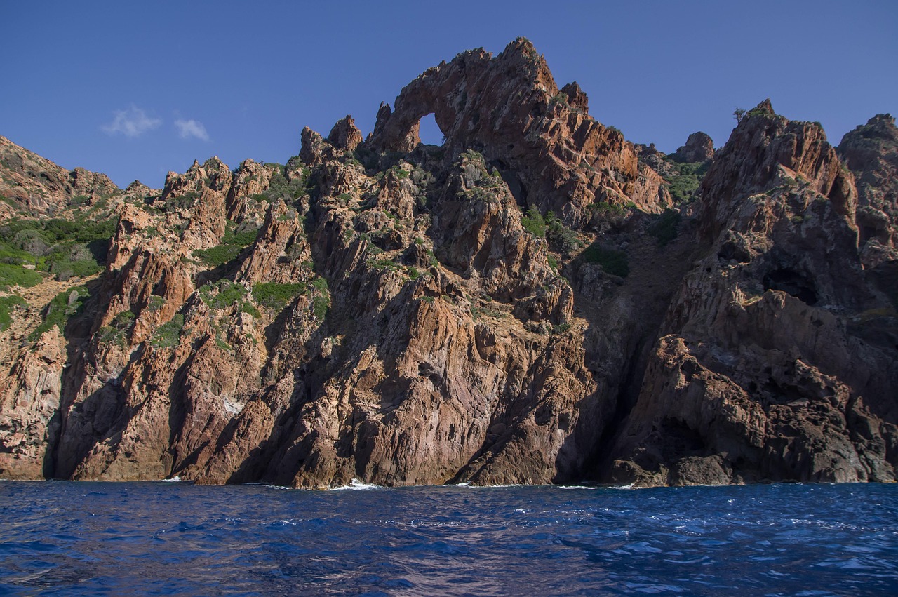
18. Aiguilles de Bavella & Col de Bavella
The spires of Bavella are both a natural wonder and a cultural symbol. A large cross above the pass reflects Corsica’s deep Catholic heritage, while the crags themselves are playgrounds for climbers.
From the pass, short trails lead to viewpoints ideal for non-GR20 visitors — a perfect day trip for those touring Corsica by car who want a taste of the GR20 atmosphere.
Eating & Sleeping Along the GR20
Think of the GR20’s refuges, gîtes, and bergeries as your “motels, diners, and roadside inns” on this mountain road. They shape the rhythm of your days and nights.
Refuges
Run by the Parc Naturel Régional de Corse, official refuges offer:
- Dormitory bunks (bookable in advance for 2026 – strongly recommended for peak season).
- Designated camping areas where you can pitch your own tent.
- In many cases, tent rental (you reserve a spot + tent).
- Simple meals: usually breakfast (bread, jam, hot drink), dinner (soup, main, dessert), and sometimes picnic lunches to go.
Food is basic but hearty. Over the years I’ve noticed refuges slowly improving vegetarian options — by 2025, most could rustle up a meat-free main if warned in advance, though strict vegans still face challenges. Prices rise slightly each season; budget roughly €25–€35 per day for refuge meals in 2026 if you eat breakfast and dinner there.
Bergeries & Private Gîtes
These are often the highlights of GR20 cuisine:
- Grilled meats (lamb, pork, or goat) cooked over open fire.
- Brocciu cheese served fresh or baked in fiadone.
- Chestnut-based dishes — polenta-like staples, cakes, beer.
- House wine and homemade liqueurs (myrtle, citron, chestnut).
In several bergeries between Prati and Asinau, I’ve had slow, late dinners that felt almost like family gatherings, with the owners sitting at our table and telling stories of wolves, old transhumance routes, and changing climate.
Planning “Fuel Stops” & Budget
- Breakfast: Often at the refuge, though many hikers prefer a quick coffee and bar and start early.
- Lunch: I almost always carry my own — bread, cheese, sausage, dried fruit, nuts. It’s cheaper and more flexible.
- Dinner: I usually eat at refuges or bergeries. After a long day, cooking from scratch is possible but tiring.
- Budget: For 2026, a realistic budget per person for food + lodging on the GR20 is:
- Camping & self-catering: ~€35–€45/day.
- Mix of camping and refuge meals: ~€50–€65/day.
- Refuge bunks + full board: ~€70–€90/day.
I personally like a hybrid approach: tent-camping most nights, cooking some simple meals, but planning 3–4 “treat” nights at bergeries or gîtes (Ascu, Vergio, Vizzavona, Bavella) for morale and comfort.
Evenings on the GR20: After Dark in the High Country
Evenings are when the GR20 feels most like a traveling village.
Refuge Evenings
After dinner, people linger outside or in common rooms. Card games, route planning with topo maps, comparing GPS tracks, treating blisters. On clear nights, I always encourage my clients to step away from the refuge lights and lie on a rock or patch of grass to watch the stars. The Milky Way is bright, and shooting stars aren’t rare in August.
Small-Town Nights
In places where the trail briefly brushes the “road world” — Ascu-Stagnu, Castel di Vergio, Vizzavona, Bavella, and especially the villages off-trail — evenings have more of a small-town feel: simple bars, laughter from terraces, sometimes live music in high season.
In Vizzavona in 2024, a local band played Corsican polyphony and modern folk at a hotel terrace; hikers sat nursing beers, too tired to dance but swaying gently in their chairs.
Where to Linger vs. Push On
- Worth a proper night: Vizzavona (rest & reset), Castel di Vergio (civilization hit), Bavella/Conca (celebration, access to coast), any bergerie with a reputation for good food.
- Good to “blow through” if short on time: Some mid-route refuges where facilities are basic and scenery is less distinctive — though each has its charm, the GR20 is long, and you’ll naturally find a rhythm of places that call you to linger.
Day Trips & Nearby Attractions Off the GR20
If you have extra days before or after your GR20, or if some companions prefer car-based sightseeing while others hike, there are excellent side trips.
1. Calvi & the Balagne Villages
From Calenzana, a short drive brings you to Calvi, with its citadel, harbor, and long sandy beach. Inland, the hill villages of the Balagne (Sant’Antonino, Pigna, Lumio) offer artisan shops, little restaurants, and spectacular coastal views.
2. Restonica Valley (Corte)
From Corte, the Restonica valley leads to Lac de Melo and Lac de Capitellu by a popular day-hike route. It’s a great way for non-GR20 hikers to see some of the same scenery from below.
3. Ajaccio & Gulf of Porto
From Vizzavona, trains run to Ajaccio. Combine a couple of rest days at sea level with boat trips to the Calanques de Piana and the Scandola nature reserve for a complete mountain-sea Corsican experience.
4. Bavella Adventure Sports
Near Bavella, guides offer canyoning, rock climbing, and via ferrata — ideal for adventurous couples or families who want an adrenaline hit without committing to the full GR20.
Culture, Etiquette & Local Customs on the GR20
Respect for Land & Livestock
- Close gates behind you; they protect flocks, not you.
- Give sheep, goats, and semi-wild pigs a wide berth. Don’t feed them; it encourages bad behavior.
- Stay on marked trails to reduce erosion, especially around lakes and bogs.
Refuge Etiquette
- Quiet hours are usually from around 22:00. Headlamps off, voices low.
- Take your boots off before entering dorms; use provided clogs or sandals.
- Pack in the evening if you plan an early start to avoid rustling at 4:30 a.m.
Language & Local Identity
Corsica has a strong regional identity. Many locals speak both French and Corsican; road signs are often bilingual. Learning a few Corsican words (like bonghjornu for good morning, grazie for thank you) goes a long way.
Conversations about politics and independence can be sensitive. Listen more than you speak, and avoid sweeping statements about “France” vs “Corsica.”
Religious & Cultural Sites
Chapels and roadside shrines (like at Bavella) are active sites of devotion. Dress respectfully, avoid loud behavior, and don’t climb on religious structures for photos.
Practical Logistics & Travel Advice for the GR20 (2026–2027)
How to Get There & Around
- Airports: Bastia, Calvi, Ajaccio, and Figari serve the island. For GR20:
- North end (Calenzana): fly to Calvi or Bastia.
- South end (Conca): fly to Figari or Bastia/Ajaccio + bus/shuttle.
- Trains: Narrow-gauge trains link Bastia–Corte–Ajaccio and Bastia–Calvi via Ponte-Leccia. Vizzavona is on the Bastia–Ajaccio line.
- Buses & shuttles: Seasonal services connect trailheads and coastal towns. In 2026, expect continued shuttle options Calvi–Calenzana and Conca–Porto-Vecchio, but schedules can be sparse; always check locally and consider booking.
Permits, Booking & Regulations
- No special hiking permit is required, but:
- Refuge bookings are essential in high season (June–September) via the PNRC website.
- Wild camping outside designated refuge/bergerie areas is generally prohibited.
Visas & Driver’s Licenses
- Corsica is part of France and the EU. Schengen visa rules apply. Many nationalities get 90 days visa-free; verify for your passport.
- Driving to/from trailheads: foreign drivers’ licenses are widely accepted; an International Driving Permit is recommended if your license is not in French or English.
SIM Cards & Connectivity
- French SIMs from Orange, SFR, Bouygues, Free all work on Corsica, but coverage on the GR20 itself is patchy.
- In 2025, Orange generally had the best high-mountain coverage, but expect long dead zones. Don’t rely on mobile signal for navigation or emergency contact.
- Download offline maps (IGN topo via apps) before starting.
Best Seasons & Seasonal Closures
- Early season (late May–mid June): Snow can linger on high passes; ice axe and microspikes may be necessary. Refuges open progressively; check dates.
- Main season (mid June–early September): Most popular. All refuges open, shuttles running, but also the busiest and hottest at lower elevations.
- Late season (September–early October): My favorite — cooler, fewer people, often clearer skies. Some services close by late September; days shorter, early storms possible.
- Off-season: Winter and early spring attempts are serious mountaineering undertakings; not covered by this guide.
Vehicle Suitability & “Road Trip” Logistics
While the GR20 itself is a footpath, many travelers combine it with a Corsican road trip:
- Vehicles: Regular cars are fine for main roads and access to Calenzana, Vizzavona, Bavella, and nearby towns. Some smaller mountain roads are narrow and twisty; drive cautiously.
- Fuel/charging: Fuel stations are available in all major towns; in the high interior they are sparse, so fill up in Corte, Calvi, Porto-Vecchio, Ajaccio, or Bastia before detours. EV charging is improving but still limited inland; check updated maps if renting an EV in 2026–2027.
- Breakdowns: Roadside assistance is available on main routes; on remote mountain roads, response times can be long. For the trail itself, “breakdown” means injury — evacuation is by foot or helicopter in serious cases.
Pacing & Distance
- Classic 14-stage GR20: 14–16 days, 5–8 hours per day.
- 10 leg itinerary (like this guide): 10–12 days, with some longer days.
- 7–9 leg itineraries: For very fit, experienced hikers only; daily elevation gain can exceed 1,500 m regularly.
Be realistic about your fitness. Every season I see people overestimate and either quit by Vizzavona or suffer through the last days in misery.
How to Save Money
- Bring a lightweight stove and some dehydrated meals to reduce dependence on refuge dinners.
- Buy bulk items (nuts, pasta, chocolate) on the mainland or in big Corsican supermarkets (Corte, Ajaccio, Bastia) before heading to the trail.
- Share taxis and shuttles with other hikers whenever possible.
- Camp rather than sleep in dorms when weather allows; camping fees are lower.
Safety & Breakdown Options on the Trail
- Every major refuge has radio contact or mobile coverage for emergencies; serious cases can trigger helicopter rescue.
- Several points offer bail-outs to roads and villages (Ascu, Vergio, Vizzavona, Bavella). Study these beforehand as your “emergency exits.”
- Carry a small but solid first aid kit; blisters and tendonitis are more common than dramatic falls but can be just as trip-ending.
Events & What’s New for GR20 in 2026–2027
- Trail Maintenance & Signage 2026: The PNRC is planning refreshed waymarking in several northern sections and minor re-routings around erosion-prone zones between Manganu and Pietra Piana. Expect short diversions and clearer signage.
- Cultural Festivals Nearby:
- Fiera di u Casgiu (Cheese Fair) in Venaco, spring 2026 & 2027 — an excellent add-on before or after walking part of the GR20, showcasing Corsican cheeses.
- Polyphonic music festivals in Pigna and other Balagne villages in summer — possible to attend if you start or end around Calenzana/Calvi.
- Environmental Initiatives: Continued emphasis on Leave No Trace, with new educational panels at major access points like Vizzavona and Bavella. Expect more visible ranger presence during peak months.
Summary & Final Recommendations: When & How to Walk the GR20
The GR20 is often called Europe’s toughest long-distance trail, but I think of it instead as Europe’s most honest one. It demands fitness, planning, and humility, but it gives back more than any spreadsheet of distances and ascents can convey: dawns over the Balagne, star-sprayed nights at Ciottulu, laughter in smoky bergeries, and the deep satisfaction of crossing an island by its mountain spine.
Best Seasons
- June & September: My top picks. Fewer crowds, more stable temperatures, beautiful light. In early June, check snow conditions; in late September, monitor for early storms.
- July–August: Viable, but be ready for heat at lower elevations and busy refuges. Book everything early.
Choosing Your Itinerary Length
- 7–9 leg itineraries: For very fit, experienced mountain hikers wanting a fast, intense traverse.
- 10–12 legs of GR20 Trail (like this guide): Ideal for most fit trekkers who want challenge without constant overload.
- 13–14 legs: Best for those preferring shorter days, time for swims and side trips, or those hiking with teens or older family members.
Key Takeaways
- Start north to south if this is your first time; it makes the psychological arc kinder.
- Use Vizzavona as your pivot: rest, regroup, decide whether to continue or exit.
- Embrace the local food and bergeries; they’re as much a part of the GR20 as the ridges.
- Respect the weather, the land, and local customs. The GR20 is a living landscape, not an amusement park.
Most of all, give yourself the time and mental space to be changed by the journey. Whether you follow a 10 leg itinerary for GR20 Trail or stretch it to 14 legs of GR20 Trail, you’ll finish in Conca a different person from the one who stood in Calenzana. And years later, when the blisters have faded, you’ll still be able to close your eyes and smell the maquis, hear the ring of goat bells, and see the long mountain “road” of the GR20 winding away beneath your boots.